 Enlarge
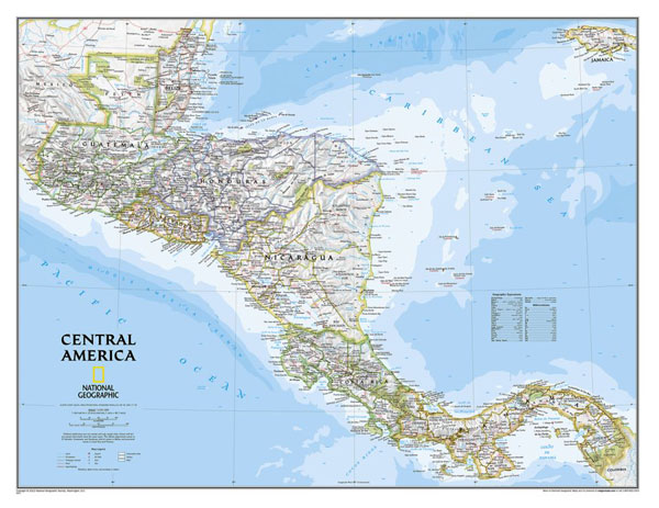
Central America NGS Laminated 73 x 57
$65.00
Central America, from Guatemala and Belize to Panama, by National Geographic in their traditional classic style with a light coloured base and different coloured country boundaries. Internal administrative borders and province names are also included.Topography of the region is shown by light relief shading with names of mountain ranges with peak heights in metres, swamps, seasonal lakes and coral reefs are marked. Main roads, rail connections, domestic airports, National parks and selected archaeological sites are highlighted. Latitude and longitude lines are drawn at intervals of 3°.
Also available FRAMED, please phone/email for quote or click on 'Options' to add Rods to your map.
73cm wide x 57cm drop