 Enlarge
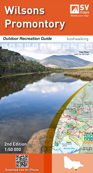
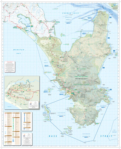
Wilsons Promontory 1:50k Spatial Vision
$20.00
An outdoor recreation and bushwalking guide to Wilson's Promontory at an appropriate scale of 1:50,000. Included with the map is an inset of Tidal River (1:4,500), and marked on the map are marine recreation symbols as well as relevant symbols for tourers, campers and bushwalkers. On the reverse is a map of Corner Inlet (1:4,500) as well as information on day and overnight walks, the region's history, fire and flood situations, flora and fauna, bushwalking safety as well as some prominent beach walks. Includes information & symbols for tourers, bushwalkers and campers
84cm wide x 103cm drop
Printed In-House
Click on 'Options' for another finish ..............