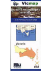
Victoria
-
Eildon Special 50k Vicmap
This map includes the whole of Lake Eildon plus Mansfield, Jamieson, Eildon, Goughs Bay, Howqua…
$14.00
-
Bush Huts Around Mansfield Rooftop
Each hut is described with a brief background history and a colour photograph. The detailed…
$8.00
-
Cann River - Orbost - Delegate Adventure Rooftop
This map extends from Orbost and McKillops Bridge to Cann Valley Highway and Tamboon Inlet. An…
$16.00
-
Cohuna - Echuca - Gunbower Forest Activities Hayman's
Including the Murray River Red Gum Forestsl Perricoota, Koondrook, Campbell's Island, Guttrum…
$11.00
-
Mallacoota 8822-N 1:50,000 Vicmap
Croajingolong National Park east of Mallacoota. Entire Mallacoota Inlet, Cape Howe Wilderness, Gipsy…
$14.00
-
Dartmouth - Cobberas 4WD Spatial Vision #5
Covering Omeo, Mt Anderson Peak, Thredbo, Mt Benambra, and Lake Dartmouth, the map has a unique…
$12.00
-
The Peninsula Special 1:50,000 Vicmap
Map coverage includes the whole of the Bellarine Peninsula on one side and Mornington Peninsula…
$14.00
-
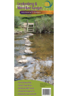
Gippsland Lakes Ninety Mile Beach Adventure
Coverage of the coastline extends from McLoughlins Beach to Lakes Entrance inland to Heyfield…
$16.00
-
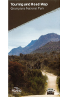
Grampians National Park Parks Victoria
This map is ideal for 4WDing & touring the Grampians National Park. The map highlights all of…
$6.00
-
Wilsons Promontory Special 1:50k Vicmap
Map coverage includes the whole of Wilsons Promontory National Park plus Yanakie and Duck Point at…
$14.00
-
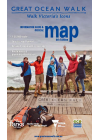
Great Ocean Walk - Parks Victoria
Information guide and official map for The Great Ocean Walk from Apollo Bay to The Twelve Apostles…
$16.00
-
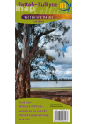
Hattah-Kulkyne Meridian
1:75,000 scale topographic map covering the Hattah-Kulkyne National Park and the Murray Kulkune Park…
$11.00
-
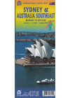
Australia Southeast & Sydney ITMB
This map of Southeast Australia & Sydney by ITMB is double sided. One side @ 1:2,000,000…
$18.00
-
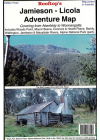
Jamieson - Licola Adventure Rooftop
This map covers from Goughs Bay, Jamieson and the Howqua River in the north to the Upper Thomson…
$13.00
-
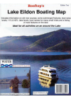
Lake Eildon Boating Rooftop
This a special map focusing on all the relics, ruins and sites submerged when the lake is full and…
$9.00
-
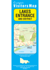
Lakes Entrance & District Craigies
The Lakes Entrance & District Map extends from Bruthen in the North to Loch Sport in the South…
$7.00
-
Lerderderg & Werribee Gorges Meridian
1:30,000 scale topographic map of the Lerderderg State Park and 1:20,000 map of Werribee Gorge State…
$11.00
-
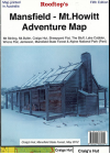
Mansfield - Mt. Howitt Adventure Rooftop
Map coverage is from Mansfield and Lake Cobbler in the north to Jamieson, Kevington and Mount Sunday…
$9.00
-
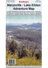
Marysville - Lake Eildon Adventure Rooftop
Map coverage is from Mansfield, Bonnie Doon and Merton in the north to Warburton Upper Yarra…
$15.00
-
Mornington Peninsula Walks Meridian
Double-sided multi-scaled map of Mornington Peninsula National Park and Arthurs Seat State Park…
$11.00