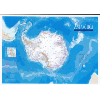
Antarctica Geoscience 1:10m Laminated
$50.00
An attractive multicoloured map of the entire Antarctic continent. In addition to major rock features, the map shows the shape of the ice cap through contours, spot elevations, ice thicknesses and relief shading. Depth contours depict the bathymetry of the adjacent seas. Scientific stations of the Antarctic Treaty nations are also shown. Heard and Macquarie Islands at 1:250,000 scale and the McDonald Islands at 1:125,000 scale are included as insets.
74cm wide x 82cm drop


