Barcelona National Geographic
$20.00
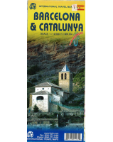
NGS' map of Barcelona combines a city map and travel guide. The easy-to-read road map covers the city from the Les Corts and Sants-Montjuic districts in the south and west to Sant Marti in the northeast. Included are hundreds of points of interest, such as metro and railway stations, places of worship, notable buildings, parks, police stations and hospitals, along with 3D depictions of many top attractions.
One side has a regional map and descriptions of the city, many popular points of interest and the transit system. The user-friendly index of streets, hotels and train stations, the diagram of Barcelona Airport and the comprehensive metro map will help you plan your route. An inset map of Ciutat Vella district is included.
Printed on durable synthetic paper, making it waterproof, tear-resistant and tough — capable of withstanding the rigors of international travel.


