 Enlarge
Helambu Langtang Nepal 1:100,000
$25.00
Sale $20.00
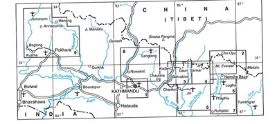
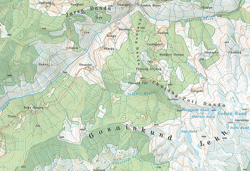
This map of Helambu Langtang by Nelles @ 1:100,000 was originally prepared by E. Schneider and now edited by the German Scientific Association of Comparative High-Mountain Research. The map covers the the Langtang valley, Naya Kanga, Kangja La Pass, Gosainkund, and parts of the Indrawati and Trisuli Rivers. Contours are at 100m intervals. Trekking routes are marked but without highlighting any specific trails or providing other tourist information. Geographical coordinates are given by margin ticks for latitude and longitude at 5’ intervals. Map legend is in English. Current edition of this map was published in 1998.
Traditionally referred to as “the Schneider maps”, titles in this series cover Nepal’s most popular trekking regions at 1:50,000 or 1:100,000. The maps were originally prepared by the Austrian climber and cartographer Erwin Schneider and for nearly five decades provided the best and often the only coverage of these areas. Now sponsored by the German Scientific Association of Comparative High-Mountain Research, the maps are still quoted in most trekking guides to Nepal. Most maps have contours at 40-m intervals and, with bold relief shading and colouring for the glaciers, provide a vivid representation of the terrain.