 Enlarge
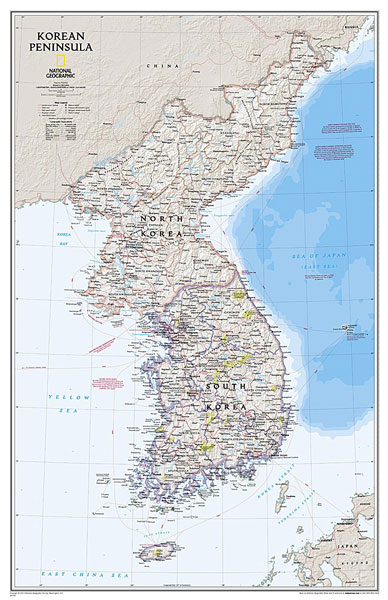
Korean Peninsula NGS Laminated 59 x 91
$65.00
National Geographic Maps' Korean Peninsula wall map is one of the most authoritative maps of the Koreas. The peninsula's rugged terrain is expertly depicted in shaded relief, including the elevation of prominent mountains and ocean depths in meters. It clearly portrays both countries and uses the latest system for transcribing South Korean place-names from the Korean alphabet. In great detail, it delineates the latest administrative divisions of both countries along with the July 27, 1953 Military Demarcation Line—the historic demarcation line between the two Koreas. The map also portrays the transportation grid of both countries, including South Korea's high-speed passenger railway network, and the underground nuclear test site or missile launch centers and federal offices.
59cm wide x 91cm drop