 Enlarge
New York State & New England ITMB
$12.00
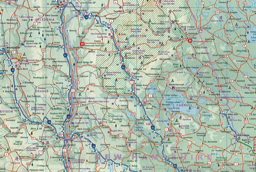
This ITMB map of New York State & New England on one side covers most of the state and the southern portion of the New England states and has an inset map of the greater NYC area. Meanwhile, the other side covers from Boston and Cape cod to the northern extremes of Maine and west into Vermont along with inset maps of Boston and Boston Region. This map highlights roads by classification, ferry routes and railways as well as various points of interest such as hotels, shopping centres, reserves, rivers and more.
This map is depicted in the scale of 1:800,000.