 Enlarge
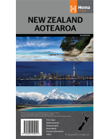
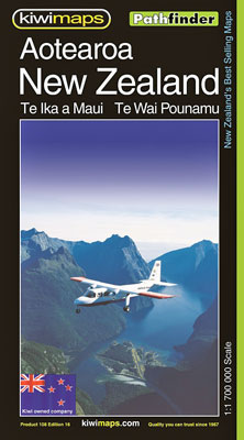
New Zealand Aotearoa Pathfinder Kiwimaps
$12.00
This Kiwimaps map of New Zealand Aotearoa features enlargements of environs of main cities, traveling times, distance tables as well as indexes for national parks, mountains, rivers, lakes, towns and villages. The road network highlights state highways and indicates tourist routes such as the Pacific Coast Highway, Thermal Explorer Highway and Alpine Pacific Triangle Route. The base map has relief shading to depict the topography, with names of mountain ranges, lakes and other geographical features. National Parks and protected areas are highlighted. The index on the reverse provides separate lists of cities/towns/localities, mountains/parks/ski fields/tracks, and rivers/lakes/bays.
The map includes separate distance tables and small maps showing travelling times for North Island and South Island. Also included are four enlargements at 1:500,000 showing the environs of Auckland, Wellington, Christchurch and Dunedin. Marked on the North Island and listed in the index is Mount Taumatawhakatangihangakoauauotamateaturipukakapikimaungahoronukupokaiwhenuakitanatahu.
This map is depicted in the scale of 1:7,000,000.