 Enlarge
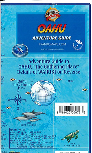
Oahu Hawaii Adventure Guide Franko
$17.00
This map of Oahu by Franko is a recreational map for scuba divers, snorkelers, kayakers, hikers, bicyclists, boaters, surfers, tourists and others who love Oahu. Printed on waterproof & tear-resistant paper.
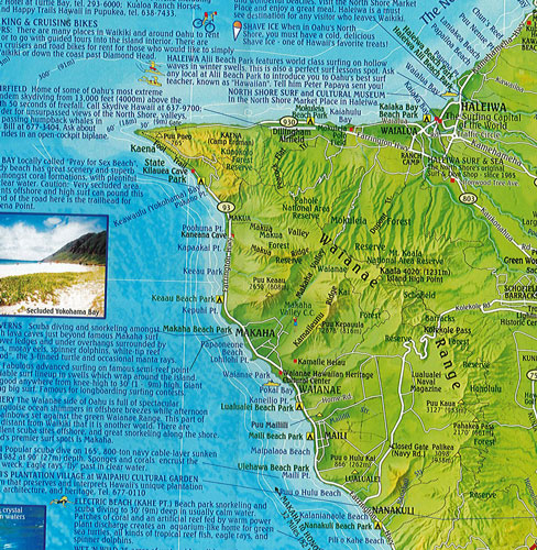
Side one shows a view of the whole island, with its mountain ranges shown in beautiful green shaded relief, as well as its freeways and major roads, plus creeks, trails and things to see or places to go. Beyond the island, the ocean waters are shown in beautiful shades of tropical ocean blue, indicating ocean depth contours. All about the island there are descriptions of its fabulous scuba and snorkeling spots, famous surfing spots and great places to visit. Favorite dive spots include Hanauma Bay, possibly the most snorkeled spot on earth; Magic Island, right next to Waikiki; the wreck of the Y0-257, which is visited by the Atlantis tourist submarine right out of Waikiki; the M/V Mahi on Oahu's west side where eagle rays soar by; Turtles, where numerous green sea turtles can been seen on almost any day; U'lua Cave, or Black Rock, where white tip reef sharks guard a big cave and many more. The North Shore not only features dive spots like Shark's Cove, Snagles, Turtle Street and Hale'iwa Trench, but also great surfing spots like Sunset Beach, Banzai Pipeline, Waimea Bay, Chun's Reef, Laniakea, and Hale'iwa. The East Shore shows where to find the Polynesian Cultural Center; the Mormon Hawaii Temple, which is probably the most beautiful edifice in the State of Hawaii; and Sandy Beach, famous for its body-whomping heavy shorebreak.
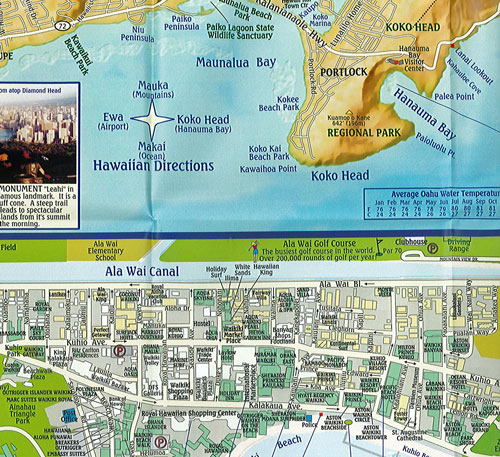
Side two Has the Oahu South Shore & Waikiki in more detail. Around the map there is a collection of artwork of tropical fish, which are named in Hawaiian and English, and depicted in a reef environment with photos by Franko.