 Enlarge

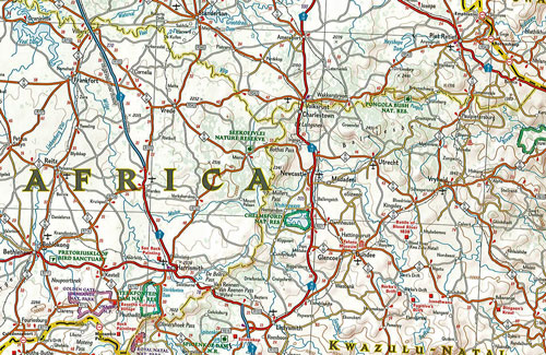
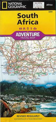
South Africa National Geographic Adventure
$22.00
This NGS map of South Africa provides global travelers with the perfect combination of detail and perspective in a highly functional travel tool. Hundreds of points of interest that highlight the diverse, unique, and exotic destinations within the country such as national parks and reserves, sanctuaries, World Heritage sites, archeological sites and museums are noted. Along the coast between Cape Town (the legislative capital) and Port Elizabeth, areas for whale watching and shark-cage diving are highlighted. Dozens of beaches are pinpointed from the Sunshine Coast to the North Coast.
The map includes the locations of cities and towns with a user-friendly index, plus a clearly marked road network complete with distances and designations for major highways, main roads, and tracks and trails for those seeking to explore more remote regions. Important travel aids like airports, airfields, rail lines, ferry routes, and lighthouses are included as well.
The west side of the South Africa map includes the Northern Cape, Western Cape, Eastern Cape and portions of the North West and Free State provinces. Johannesburg and neighboring city Pretoria (administrative capital) are included on the east side of the map along with Bloemfontein (judicial capital) and the coastal city of Durban.
Printed on durable synthetic paper, making it waterproof, tear-resistant and tough — capable of withstanding the rigors of international travel.