 Enlarge
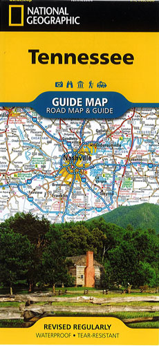
Tennessee National Geographic
$20.00
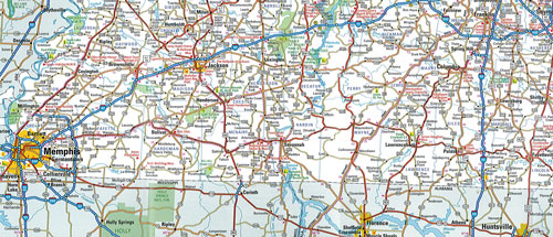
This NGS guide map of Tennessee combines a comprehensive road map with an expertly research travel guide. The road network contains designations for free access and toll highways, state and country routes, paved and unpaved roads and scenic byways. Mileage markers are shown on major highways and scenic routes have pinpointed wayside stops. An index of cities, towns and counties along with a chart of driving distances will aid in your finding your destination and planning your route.
Includes points of interest, national and state parks, national forests, campgrounds, visitor centers, airports, hospitals & ski areas. Also included are City inset maps of Knoxville, Chattanooga, Nashville, Memphis as well as the Land Between the Lakes Recreation Area. Great Smoky Mountains National Park and Natchez Trace Parkway scenic drive are given special coverage including both maps and descriptions. A calendar of events, chart of services at national parks and an overview of points of interest are all provided along with relevant contact information.
Printed on durable synthetic paper, making it waterproof, tear-resistant and tough — capable of withstanding the rigors of international travel.