 Enlarge
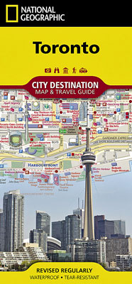
Toronto National Geographic
$20.00
This NGS City Destination map of Toronto combines a easy to read street map and travel guide. It includes a regional map and an inset map of the city center, along with information about Canada's capital city and its points of interest on one side of the map. A user friendly index of streets, hotels, public buildings, points of interest, metro stations, parks and beaches will help you find your destination. While an overview of the transit system, a comprehensive metro map and map of Toronto Pearson International Airport will aid in your navigation around the city.
A detailed street map of the city is shown on the reverse side, including the Toronto Islands as well as an inset map of the Eastern Beaches. Theaters, monuments, hotels, churches, parks, visitor information centers, notable buildings, underground walkways and pedestrian areas are clearly marked and easy to find with the multi-language legend. Many popular attractions are depicted in 3D, including the CN Tower, Ontario Parliament Buildings and Eaton Center. The location of train and metro stations, ferry routes and parking areas are included.
Printed on durable synthetic paper, making it waterproof, tear-resistant and tough — capable of withstanding the rigors of international travel.