 Enlarge
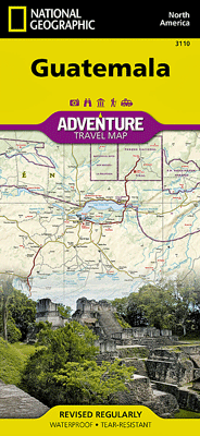
Guatemala National Geographic Adventure
$20.00
This NGS map of Guatemala is the most comprehensive map available for travelers exploring the country's rich cultural heritage and diverse natural beauty. Combining a clearly marked road network, a user-friendly index of cities and towns, topographic information and points of interest, this map is expertly researched. The mapped road network, shown with distances, includes major highways and secondary roads along with high clearance roads and tracks, for those seeking to explore off the beaten path. Additional travel information includes airports, airstrips, ferry routes, railroads and border crossings. Among the hundreds of cultural, ecological, historical and adventure destinations are national parks and other protected areas are highlighted such as archeological sites, caves, beaches, shipwrecks, coral reefs, UNESCO World Heritage Sites.
One side covers northern Guatemala and its northern border regions with Mexico and Belize. Included are the Mayan areas of El Mirador and Tikal National Park along with the island town of Flores on Lake Peten Itza. The reverse side covers the country south of the Yucatan Peninsula, bordering areas of Mexico, Honduras, El Salvador and Belize, the Pacific Ocean shoreline and part of the Gulf of Honduras. In this area you'll find the World Heritage site of Antigua, Lakes Atitlan and Izabel, Pacaya Volcano and the capital, Guatemala City.
Printed on durable synthetic paper, making it waterproof, tear-resistant and tough — capable of withstanding the rigors of international travel.