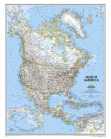
 Enlarge
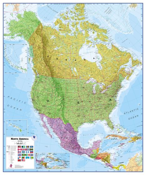
North America Maps International Laminated 1000 x 1200
$85.00
This North America political map by Maps International covers a huge expanse of land, stretching from Alaska and Canada through the United States down to Mexico, Central America and the Caribbean.
North America political map details: This political map of North America shows countries in different colors, international boundaries and major transportation networks. The North America wall map also has a panel with the flags of the countries in North America. Details include city populations, capital cities and all major towns and cities in North America.
100cm wide x 120cm drop