 Enlarge
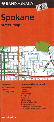
Spokane Rand McNally
$12.00
$9.00
This Rand McNally map of Spokane depicts all Interstate, U.S. state and county highways along with various points of interest such as parks, airports and shopping malls. Its full street index will help users to reach their destination easily. This map covers Airway Heights, Cheney, Deer Park, Fairchild AFB, Medical Lake, Milwood, Liberty Lake, Spokane Valley City, Spokane Country & adjoining communities as well as downtown & vicinity.