 Enlarge
Timor Leste Waterproof
$50.00
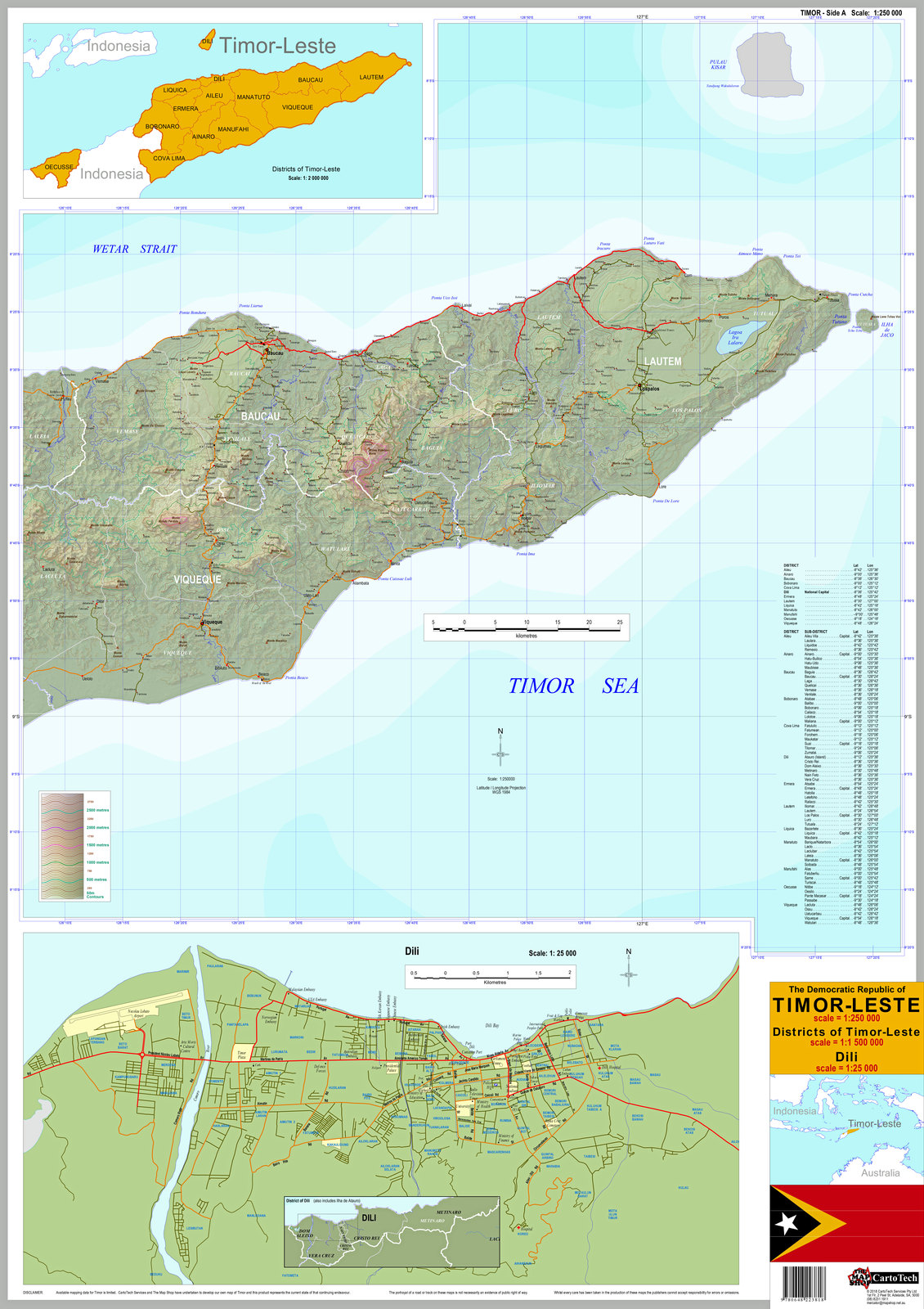
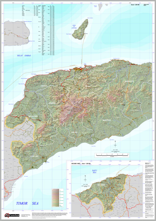
This map of Timor-Leste is @ 1:250,000 comes in 2 sheets and includes a 1:25,000 scale town map of the capital, Dili. There is also a small inset map to clearly indicate the administrative districts of the country.
Towns, villages, tracks and roads are shown on the main map along with districts and sub-districts plus some geological features and points of interests.
Did you know that the highest peak in Timor-Leste is over 700m taller than Australia's Mt Kosciuszko? That is the equivalent of stacking Mt Lofty on top of Mt Kosciuszko! You can find Mt Ramelau, it's other name and it's height on our map.
This map has been collated from a variety of historic and contemporary sources as well as with the help of Rob Hall.
The 2 sheets are 60cm wides x 85cm drop and are printed on waterproof paper