South Australia
-
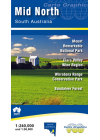
Mid North South Australia Cartographics
This map covers from Kapunda in the south to Quorn in the north. The northern Mount Lofty Ranges and…
$10.00
-
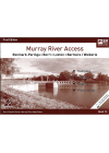
Murray River Access Book No. 13
Renmark - Paringa - Berri - Loxton - Barmera - Waikerie. This book includes good mapping (GPS…
$10.00
-
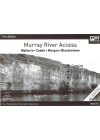
Murray River Access Book No. 14
Waikerie - Cadell - Morgan - Blanchetown. This book includes good mapping (GPS compatible) and…
$10.00
-
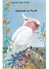
Nullarbor Plain Adelaide-Perth CartoGraphics
Nullarbor Plain Adelaide to Perth - Perth to Adelaide This beautifully illustrated map covers the…
$10.00
-
Murray River Access Book No. 15
Blanchetown - Swan Reach - Mannum. This book includes good mapping (GPS compatible) and information…
$10.00
-
Murray River Access Book No. 16
Mannum - Murray Bridge - Tailem Bend - Goolwa - Murray Mouth. This book includes good mapping (GPS…
$10.00
-
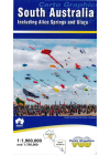
South Australia Incl. Alice Springs & Uluru CartoGraphics
The main side of this map features a full South Australia state map extending across…
$10.00
-
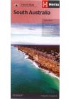
South Australia State Hema Handy
A state map of South Australia reverse side printed with northern half on one side and southern half…
$10.00
-
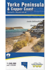
Yorke Peninsula CartoGraphics
A detailed touring map @ 1:350,000 scale of South Australia's Yorke Peninsula of South Australia…
$10.00
-
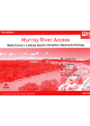
Murray River Access Book No. 10
Neds Corner - Lindsay Island - Chowilla - Renmark - Paringa. This book includes good mapping (GPS…
$10.00
-
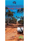
Goog's Track Map Westprint
Goog's Track has been likened to a miniture cross between the Canning Stock Route and the Simpson…
$9.00
-
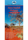
Anne Beadell Highway Westprint
This mini map of the Anne Beadell Highway shows detailed road and track information and features…
$9.00
-
Adelaide City and Suburbs RACV
RACV's map of Adelaide City and Suburbs includes Adelaide's top attractions, visitor information and…
$10.00$8.00