 Enlarge
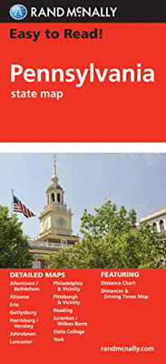
Pennsylvania Rand McNally
$17.00
$15.00
This map of Pennsylvania by Rand McNally shows all Interstate, US, state and county highways. It also includes a distance chart and a driving times map. In addition, points of interest such as parks and airports are clearly indicated in the detailed index. This map covers the areas of Allentown/Bethlehem, Altoona, Erie, Gettysburg, Harrisburg, Johnstown, Lancaster, Philadelphia & Vicinity, Downtown Philadelphia, Pittsburgh & Vicinity, Downtown Pittsburgh, Reading, Scranton/Wilkes-Barre and York.