 Enlarge
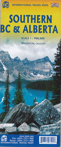
Southern British Columbia & Alberta Itmb
$22.00
This map of Southern BC & Alberta by ITMB has the southern halves of both British Columbia and its neighbour, Alberta, with a small amount of Washington State, Idaho and Montana.
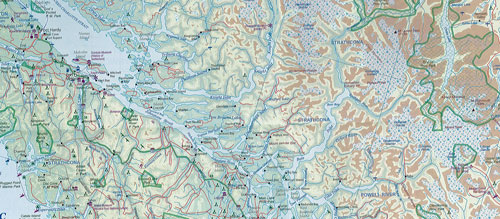
Side One covers BC from the US border (with a carry-on to Seattle) north to Prince George and east to the Alberta border, with a carry-on to Calgary. All of Vancouver Island, the Okanagan Valley, and the Rocky Mountain National Parks of Banff and Jasper are included. The map is rich with wilderness campsite (almost 1,000 are shown), ski areas, fishing areas, even gas stations in more remote parts of the vast province.
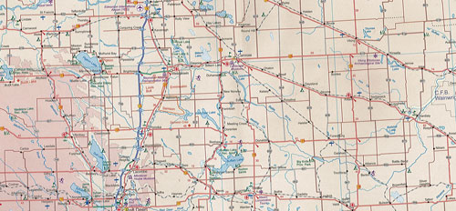
Side Two covers Alberta from somewhat north of Edmonton (the provincial capital) to the American border and a bit beyond, and from the Rocky Mountains east to a bit beyond the Saskatchewan border. This side focusses on the movement from the high Rockies to the foothills and plains of the enormous Canadian Prairies. The highlights of this side of the map are showcased in the Top Attractions guide and include such world-class features as the Drumheller Dinosaur Museum, the world’s best, to the Columbia Icefield, one of the few in the world easily accessible to walk on. The road network, train lines, urban areas, parks and numerous attractions are all clearly shown.