New South Wales & Act
-
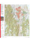
ACT Region 1:100,000 GeoSciences
The map covers an area of about 76 kilometres from east to west and about 96 kilometres from north…
$18.00
-
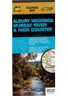
Albury Wodonga Murray River High Country Ubd 381
This map extends north to Finley, Culcain & Holbrook in NSW, east to Bullioh, Mitta Mitta…
$12.00
-
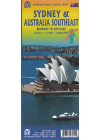
Australia Southeast & Sydney ITMB
This map of Southeast Australia & Sydney by ITMB is double sided. One side @ 1:2,000,000…
$18.00
-
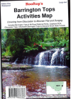
Barrington Tops Activities Map Rooftop
This map of Barrington Tops Activities by Rooftop covers the Barrington Tops and Mt Royal National…
$16.00
-

Batemans Bay AFN Fishing map # 28
Produced by the fishing experts at Australian Fishing Network - by anglers for anglers. All relevant…
$9.00
-
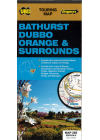
Bathurst Dubbo Orange & Surrounds UBD 282
A double sided map of the overall area and with town maps and street indexes of…
$12.00
-
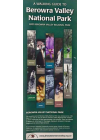
Berowra Valley National Park Walking Guide
The community-service style of the project made possible voluntary contributions by all of the many…
$8.00
-
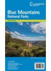
Blue Mountains National Parks Craigies
Craigies Blue Mountains National Park Map covers the Blue Mountains, Kanangra-Boyd and Abercrombie…
$13.00
-
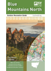
Blue Mountains North 1:50k Outdoor Recreation Spatial Vision
This recreation guide was developed in consultation with Parks Victoria and includes touring…
$20.00
-
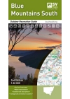
Blue Mountains South 1:50k Outdoor Recreation Spatial Vision
This recreation guide was developed in consultation with Parks Victoria and includes touring…
$20.00
-
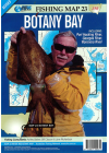
Botany Bay AFN Fishing map # 23
Port Hacking River, Georges River & Woronora River
$9.00
-
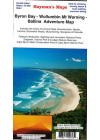
Byron Bay Wollumbin Mt Warning Ballina Hayman's
NSW Far North Coast - Includes: Lennox Head, Murwillumbah, Nimbin, Lismore, Brunswick Heads…
$12.00
-
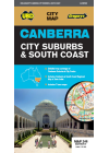
Canberra City Suburbs & South Coast UBD 248
Touring map which includes strip maps for travelling both the Princes Highway/Freeway & the Hume…
$11.00
-
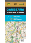
Canberra Suburban Streets UBD 259
This map is reverse side printed and extends from Hall in the north to Banks in the…
$12.00
-
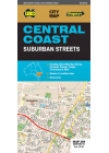
Central Coast Suburban Streets UBD 289
This map is double sided. Both sides includes a 1:25,000 scale map of the Central Coast of New South…
$12.00
-
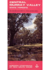
Central Murray Valley Forest
Good road and track information make navigation easy. Facility symbols identify camping, picnic and…
$8.00
-
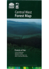
Central West Forest
An outdoor adventure map that covers the Blue Mountains including the Central Tablelands, the…
$12.00
-
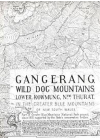
Gangerang Wild Dog Mountains
Myles Dunphy's topographic map covers the Greater Blue Mountains of N.S.W.. It is a hand drawn map…
$12.00
-
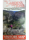
Gardens of Stone Visitors
State Conservation Areas and National Park Extensions 2nd Edition
$15.00
-
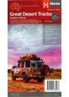
Great Desert Tracks Eastern Sheet Hema
Covering the eastern side of Australia's arid centre, the Great Desert Tracks Eastern Sheet covers…
$15.00
-
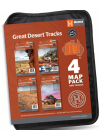
Great Desert Tracks Map Pack Hema
Includes Western, Central, Eastern Sheets plus Simpson Desert maps all with field-checked 4WD…
$60.00
-
Gundungura Map
3rd Edition 1970 Old Black & White Sketch map compiled by Sydney University Rover Crew and…
$15.00
-
Hawkesbury River & Pittwater AFN Fishing map # 29
Hawkesbury River & Pittwater
$9.00
-
Hume & Hovell Walking Track Kit
The Hume and Hovell Walking Track stretches over 440km between Yass and Albury and allows walkers to…
$30.00
-
Kiama & District Craigies
The Kiama & District Map extends from Helensburg in the North to Nowra in the South and Moss…
$9.00
-
Kosciuszko Alpine Area Spatial Vision x2 sheets W'Proof
This Kosciuszko Alpine Area map has detailed walk descriptions of some of the most popular walks in…
$30.00
-
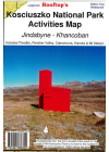
Kosciuszko National Park Jindabyne-Khancoban Rooftop
Coverage includes Thredbo, Charlottes Pass, Perisher Valley, Tom Groggin, Guthega, Geehi…
$16.00
-
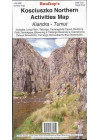
Kosciuszko Northern Activities Kiandra - Tumut Rooftop
Coverage includes Long Plain, Talbingo, Yarrangobilly Caves, Buddong Falls, Tantangara, Blowering…
$17.00
-
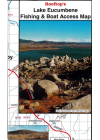
Lake Eucumbene Fishing Boat Access Rooftop
What to see around the lake, access roads and tracks, boat ramps etc. Including: Adaminaby…
$6.00
-
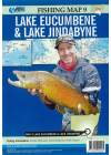
Lake Eucumbene & Lake Jindabyne AFN Fishing map # 9
Map 9 Waterproof & Tear Resistant showing you all the places and types of fish catchable. Legend…
$9.00
-
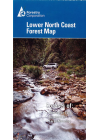
Lower North Coast New South Wales Forest
This map covers the area from Hawks Nest to Crowdy Bay in the east and from Branxton to Glenrock in…
$12.00
-
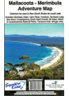
Mallacoota - Merimbula Adventure Rooftop
Includes: Bombala, Eden, Merimbula, Cann River, Wolumla, Wyndham, Wonboyn Lake, Ben Boyd NP…
$17.00
-
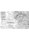
Map of Kowmung
Myles Dunphy's topographic map covers a section of the Southern Blue Mountains of N.S.W.. It is a…
$12.00
-
Map Wallet
Suits A4 & B4 size atlases and all maps
$25.00
-
Melbourne to Sydney Hema
This map takes you from Melbourne to Sydney via the Princes and Hume Highways and everything in…
$15.00
-
Merimbula-Bermagui Rooftop
Includes: Bombala, Cathcart, Wyndham, Merimbula, Tathra, Bermagui, Bega, Bemboka, Cobargo, Tilba…
$12.00
-
Mid North Coast New South Wales Drifta
This map covers from Coffs Harbour (northeast) to Central Coast (southeast) and west to Quirindi. It…
$12.00
-
Mid North Coast New South Wales Hema
This Mid North Coast New South Wales Hema map is a regional map @ 1:350,000 that covers north from…
$15.00
-

Mount Jagungal Mountain Map Handy Pocket Sutmap
This map of Mount Jagungal by Sutmap is @ 1:40,000 and is waterproof & tear resistant to…
$16.00
-
Mount Kosciuszko Perisher & Thredbo Sutmap
All year round map guide with alpine areas & ski resorts in great detail. Ideal for bush…
$17.00
-
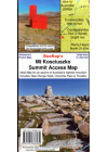
Mount Kosciuszko Summit Access Rooftop
This map is a handy pocket-sized map of access tracks to and from the highest mountain in Australia…
$6.00
-
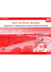
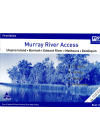
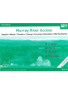
Murray River Access Book No. 1
Yarrawonga - Mulwaa - Cobram - Barooga - Tocumwal - Ulpena Island. This book includes good mapping…
$10.00
-
Murray River Access Book No. 10
Neds Corner - Lindsay Island - Chowilla - Renmark - Paringa. This book includes good mapping (GPS…
$10.00
-
Murray River Access Book No. 11
Ulupna Island - Barmah - Edward River - Mathoura - Deniliquin. This book includes good mapping (GPS…
$10.00
-
Murray River Access Book No. 12
Jingellic - Walwa - Tintaldra - Corryong - Khancoban - Murray Source. This book includes good mapping…
$10.00
-
Murray River Access Book No. 2
Barmah - Echuca - Moama - Torrumbarry Weir. This book includes good mapping (GPS compatible) and…
$10.00
-
Murray River Access Book No. 3
Albury - Wodonga - Howlong - Corowa - Wahgunyah - Rutherglen - Yarrawonga - Mulwala. This book…
$10.00
-
Murray River Access Book No. 4
Gunbower Island - Cohuna - Barham - Koondrook - Murrabit. This book includes good mapping (GPS…
$10.00
-
Murray River Access Book No. 5
Murrabit - Lake Boga - Swan Hill - Murray Downs - Nyah West - Tooleybuc. This book includes good…
$10.00
-
Murray River Access Book No. 6
Lake Hume - Woomargama NP - Jingellic - Walwa - Tallangatta. This book includes good mapping (GPS…
$10.00
-
Murray River Access Book No. 7
Tooleybuc - Boundary Bend - Robinvale - Euston - Wemen. This book includes good mapping (GPS…
$10.00
-
Murray River Access Book No. 8
Wemen - Colignan - Kings Billabong - Gol Gol - Buronga - Mildura. This book includes good mapping…
$10.00
-
Murray River Access Book No. 9
Mildura - Wentworth - Neds Corner. This book includes good mapping (GPS compatible) and information…
$10.00
-
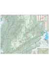
Namadgi - ACT South Rooftop
Coverage includes Namadgi National Park, Tidbinbilla Nature Reserve, Googong Foreshores, small…
$17.00
-
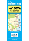
Narooma & District Craigies
The Narooma & District Map extends from Moruya in the North to Bermagui in the South. Including…
$9.00
-
 Sale
Sale
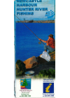
Newcastle Harbour Hunter River Fishing Laminated
Locations for fish found are numbered on index. Legend shows Navigation Aids, Activities &…
$20.00$15.00
-
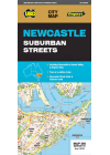
Newcastle Suburban Streets UBD 280
One side features a regional touring map which covers the Hunter Valley and surrounding region…
$12.00
-
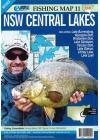
New South Wales Central Lakes AFN Fishing map # 11
Includes all these great fishing areas -Lake Burerndong, Wyangala Dam, Windamere Dam, Lake Glenbawn…
$9.00
-
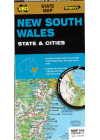
New South Wales State & Cities UBD 219
Map of the State of New South Wales on one side with the major city centres on the reverse. …
$14.00
-
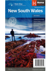
New South Wales State Hema
A state map of New South Wales accompanied by touring information and relevant regional and city…
$15.00
-
New South Wales State Hema Handy
A fully indexed state map of New South Wales printed on two sides - the eastern half of NSW on one…
$10.00
-
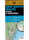
New South Wales State & Suburban UBD 270
The map has the whole state on one side at 1:1 600 000, showing major roads and tracks and…
$12.00
-
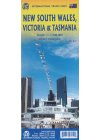
New South Wales, Victoria & Tasmania ITMB
This map bi ITMB @ 1:900,000 is a double sided map of South East Australia covering all of NSW…
$20.00
-
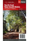
North East New South Wales Hema
A regional map of North East New South Wales that covers from Brisbane to Coffs Harbour showing…
$15.00
-
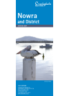
Nowra & District Craigies
The Nowra & District Map extends from Gerringong & Kangaroo Valley in the North to Cudmirrah…
$9.00
-
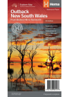
Outback New South Wales Hema
A regional map of outback New South Wales that ranges from Lithgow / Tamworth west to the…
$15.00
-
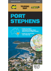
Port Stephens UBD 295
This map of Port Stephens to Myall Lakes NP, Greswick and Glen Oak to the north, west to Millers…
$12.00
-
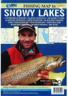
Snowy Lakes New South Wales AFN Fishing map # 16
This map includes these great fishing spots - Tantangara, Talbingo, Blowering, Tooma, Tumut…
$9.00
-
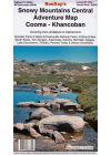
Snowy Mountains Central Cooma-Khancoban Rooftop
Includes: Parts of Alpine and Kosciuszko National parks, Tom Groggin, Adaminaby, Kiandra, Berridale…
$15.00
-
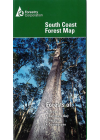
South Coast Forests New South Wales Map
This map covers the coastal region around those towns including Jervis Bay plus the state forests…
$12.00
-
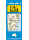
South Coast New South Wales Craigies
The South Coast Map extends from Sydney in the North and to Bairnsdale in the South @ 1:1m and has a…
$9.00
-
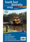
South East Australia Meridian
1:1,250,000 scale wall map of South East Australia covering the most populous corner of Australia…
$15.00
-
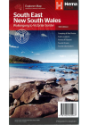
South East New South Wales Hema
South East New South Wales Map (5th edition) - a regional map of South East NSW (1:385,000) that…
$15.00
-
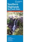
Southern Highlands Craigies
The Southern Highlands map extends from Picton in the north to Nowra in the south & west to…
$10.00
-
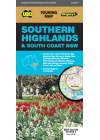
Southern Highlands & South Coast of New South Wales UBD 283/298
Regional touring map covering the coast from Shellharbour in the north to Eden in the south and west…
$12.00
-
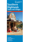
Southern Highlands Towns & Villages Craigies
The Southern Highlands Towns & Villages Map is a supplement to the Southern Highlands Map and…
$5.00
-
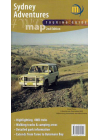
Sydney Adventures 4WD Meridian
1:500,000 scale map covering the best four wheel driving regions north and south of Sydney. From…
$15.00
-
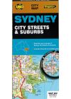
Sydney City Streets & Suburbs UBD 262
Suburban map - showing all suburbs, main & secondary roads with names and smaller streets as…
$14.00
-
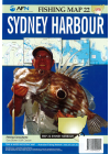
Sydney Harbour AFN Fishing Map # 22
Sydney Harbour - Middle Harbour - Parramatta River & Lane Cove River. All you need to catch a few ! Tear…
$9.00
-
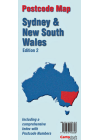
Sydney & New South Wales Postcodes Carto
Map of Sydney on one side & New South Wales on the reverse with all postcode boundaries and…
$35.00
-
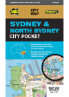
Sydney & Nth Sydney City Pocket Ubd 260
This map has Sydney City & North Sydney CBD with buildings and street index also with…
$9.00
-
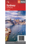
Sydney & Region Hema
A map that has the greater Sydney area (1:100,000) on one side and maps of the Sydney Region…
$10.00
-
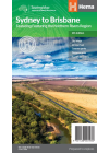
Sydney to Brisbane Hema
This map covers the two major eastern routes between Sydney and Brisbane - the Pacific and New…
$15.00
-
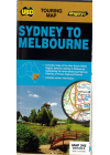
Sydney to Melbourne UBD 245
Sydney and Melbourne highlighting the Hume & Princes Highways and also includes tourist…
$12.00
-
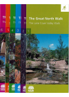
The Great North Walk Map Kit
The Great North Walk, a 250 kilometre bush walking track linking Sydney city with the Hunter Valley…
$30.00
-
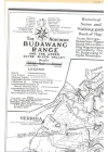
The Northern Budawang Range - Historical Anniversary Ed 1986
Historical - Anniversary Ediiton 1986 Printed on coated paper 105gsm 60cm x 85cm @ $15.00 Printed on…
$15.00
-
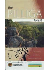
The Pilliga Forest
This map is bounded by Pilliga & Narrabri in the north to Coonabarabran in the south and shows…
$10.00
-
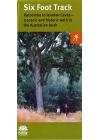
The Six Foot Track Map
Winding through State forests and national parks, the track follows the 45 kilometre…
$19.50
-
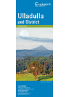
Ulladulla & District Craigies
The Ulladulla & District Map extends from Wandandian in the North to Merry Beach in the South…
$9.00
-
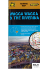
Wagga Wagga & The Riverina UBD 284
This map extends to the north Rankins Springs, Grenfell and Cowra, to the east Wyangala and…
$12.00
-
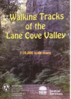
Walking Tracks Lane Cove Valley STEP
This full-colour, double-sided map shows bush tracks, cycleways and fire trails with connecting…
$20.00
-
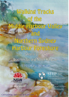
Walking Tracks Middle Harbour Valley & Northern Sydney 3&4 STEP
1:10,000 scale Middle Harbour Valley & Northern Sydney Harbour Foreshore - Northbridge &…
$20.00
-
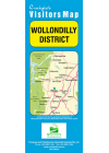
Wollondilly District Craigies
This map extends from Warragamba in the North to Yanderra in the South to Lake Burragorang in the…
$9.00
-
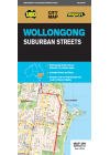
Wollongong UBD 299
This map covers Wollongong and it's surrounding suburbs and includes maps of Nowra and Berry and…
$12.00
Showing 1 — 94 of 94