 Enlarge
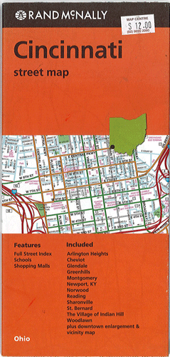
Cincinnati Rand McNally
$12.00
$9.00
This Rand McNally map of Cincinnati depicts all Interstate, U.S. state and county highways along with various points of interest such as parks, airports and shopping malls. Its full street index will help users to reach their destination with ease. This map contains detailed maps of Arlington Heights, Cheviot, Glendale, Greenhills, Montgomery, Newport, Ky, Norwood, Reading, Sharonville, St. Bernard, The Village of Indian Hill, Woodlawn and downtown enlargement & vicinity.