Great Britain & Ireland
Shop by Category
-
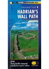
Hadrian's Wall Path Harvey
This Harvey Hadrian's Wall Path follows this route of this historic trail in detail. General…
$40.00
-
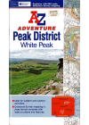
Peak District & White Peak AZ
This AZ Atlas of Peak District & White Peak is ideal for walkers and outdoor activities as it…
$28.00
-
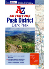
Peak District & Dark Peak Adventure AZ
Peak District: Dark Peak Adventure Atlas @ 1:25,000 by AZ publishing uses cartography from the…
$28.00
-
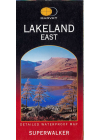
Lakeland East Harvey
Harvey's Lakeland East - a walkers map @ 1:25,000 and as used by the Patterdale Mountain Rescue…
$28.00
-
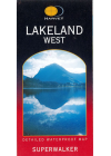
Lakeland West Harvey
Harvey's Lakeland West - a walkers map @ 1:25,000 and as used by the Patterdale Mountain Rescue…
$28.00
-
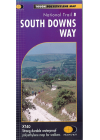
South Downs Way Harvey
This Harvey map of South Downs Way covers this route of the National Trail in detail. General…
$28.00
-
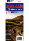
Ireland Ordnance Survey
One of Ireland's most popular maps, featuring detailed road network, holiday information, scenic…
$28.00
-
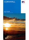
Cornwall Tour Ordnance Survey
The British Ordnance Survey map of Cornwall @ 1:100,000 will help you to discover this area - the…
$26.00
-
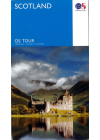
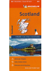
Scotland Ordnance Survey
The Ordnance Survey Tour Map series is a must for anyone visiting Britain's most popular holiday…
$26.00
-
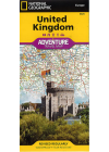
United Kingdom National Geographic Adventure
The NGS United Kingdom Adventure Map is detailed, accurate and user-friendly. One side covers…
$25.00
-
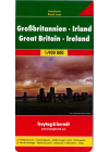
Great Britain & Ireland Freytag & Berndt
Explore Great Britain & Ireland with this Freytag&Berndt double-sided road map. The best way…
$25.00
-

Great Britain Borch
Folded road and travel map in color. Scale 1:800,000 showing motorways to secondary roads. Legend…
$25.00
-
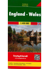
England Wales Freytag & Berndt
This map of England Wales by Freytag & Berndt @ 1:400,000 is double sided with the Western half…
$25.00
-
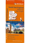
South East England - Midlands, East Anglia #504 Michelin
South East England, The Midlands and East Anglia #504 is an indexed touring map @ 1:400,000 by…
$25.00
-
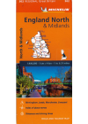
England North & Midlands #502 Michelin
Thi North Englanc & Midlands regional touring map @ 1:400,000 by Michelin contains the practical…
$25.00
-
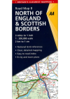
North of England & Scottish Borders AA
This map combines clear design and an easy-to-read scale with more road detail to ensure that you…
$25.00
-
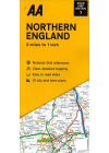
Northern England AA
This map combines clear design and an easy-to-read scale with more road detail to ensure that you…
$25.00
-
Northern England Ordnance Survey
The Ordnance Survey Road map series are single sided folded maps with the 8 maps providing GB wiht a…
$25.00
-
The Cotswolds & Gloucestershire Ordnance Survey
The Ordnance Survey Tour Map series is a must for anyone visiting Britain's most popular holiday…
$25.00
-
South West Coast Path AZ
This AZ Atlas of the South West Coast Path follows along the Somerset, Devon, Cornwall and Dorset…
$25.00
-
London 3 in 1 City Map Hallwag
This 3 in 1 city map of London by Hallwag provides a map with transport information and city…
$25.00
-
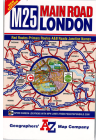
London M25 Main Road AZ
This London M25 road map by AZ shows the area within and adjoining to London’s orbital…
$25.00
-
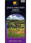
Offa's Dyke Path North Harvey
Harvey's Offa's Dyke Path North (Knighton to Prestatyn) is a clear and easy to read, waterproof map…
$25.00
-
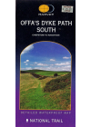
Offa's Dyke Path South Harvey
Harvey's Offa's Dyke Path South (Chepstow to Knighton) is a clear and easy to read, easy to fold…
$25.00
-
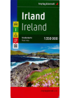
Ireland Freytag & Berndt
This map of Ireland by Freytag & Berndt is a double sided print @ 1:350,000 having the northern…
$25.00
-
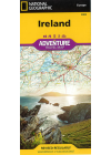
Ireland National Geographic Adventure
This NGS map of Ireland is designed to meet the needs of adventure travelers with its detailed and…
$25.00
-
Scotland Michelin 501
This map of Scotland @ 1:400,000 is an indexed touring map by Michelin and is particularly good for…
$25.00
-
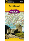
Scotland National Geographic Adventure
This NGS map of Scotland provides global travelers with the perfect combination of detail and…
$25.00
-
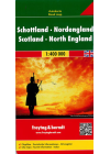
Scotland & Northern England Freytag & Berndt
A double sided map @ 1:400,000 enabling great detail with the northern part of Scotland on one side…
$25.00
-
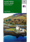
Northern Scotland - Ordnance Survey 1
The Ordnance Survey Road map series are single sided folded maps with the 8 maps providing GB wiht a…
$25.00
-
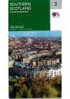
Southern Scotland - Ordnance Survey 3
The Ordnance Survey Road map series are single sided folded maps with the 8 maps providing GB wiht a…
$25.00
-
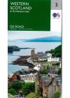
Western Scotland - Ordnance Survey 2
The Ordnance Survey Road map series are single sided folded maps with the 8 maps providing GB wiht a…
$25.00
-
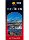
The Cuillin (Skye) Harvey
Harvey's The Cuillin (Skye) is a clear and easy to read, waterproof map showing ridge enlargement…
$25.00
-
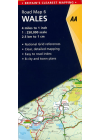
Wales AA
Wales Road map by AA (Automobile Association UK) @ 1:250,000 is a clear design with an easy-to-read…
$25.00
-
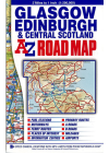
Glasgow Edinburgh & Central Scotland AZ
This A-Z map of Glasgow, Edinburgh & Central Scotland maps south of Glencoe and Montrose, to the…
$23.00
-
Great Britain ITMB
This map of Great Britain combines a detailed road map with a touristic sites map @ 1:720,000…
$20.00
-
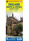
England North & Central Railway & Road ITMB
This ITMB map of England North & Central Railway & Road covers from…
$20.00
-
England South East & Midlands Railway & Road ITMB
South East England - from the English Channel north to the northern tip of East Anglia and west to…
$20.00
-
England South & Wales Itmb
This England South (or Southern England) including Wales is great for those who fly into one of…
$20.00
-
Southern England Wales Marco Polo
This Marco Polo map of Southern England and Wales @ 1:300,000 will help you discover a region of…
$20.00
-

Central Southern England AA 2
This AA road map of Central Southern England combines clear indexing and detailed mapping with an…
$20.00
-
East Midlands & East Anglia - Ordnance Survey 5
The OS map of East Midlands & East Anglia includes all motorways, primary routes and A…
$20.00
-
South East England - Ordnance Survey 8
The OS map of South East England includes all motorways, primary routes and A roads across…
$20.00
-
Wales/Cymru & West Midlands - Ordnance Survey 6
The OS map of Wales/Cymru & West Midlands includes all motorways, primary routes and A…
$20.00
-
North & Mid Wales/Gogledd A Chanolbarth Cymru Ordnance Survey
This touring map of North & Mid Wales/Gogledd A Chanolbarth Cymru will help users to plan…
$20.00
-
London & Southeast England ITMB
This London & Southeast England map by ITMB has Southeast England @ 1:300,000 on one side &…
$20.00
-
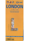
London Borch
Laminated folded street and travel map @ 1:11,000/1:15,000 with a legend including museums…
$20.00
-
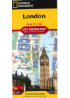
London National Geographic
This NGS map of London combines a city map and travel guide. The reverse side presents an…
$20.00
-
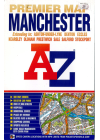
Manchester AZ
This map of Manchester by AZ provides coverage of the M60 orbital motorway, Ashton-Under-Lyne…
$20.00
-

Ireland ITMB
A double sided map of Ireland by ITMB @ 1:350,000. One side covers the northern half and this…
$20.00