USA
-

San Francisco Borch
This easy-to-fold laminated city map of San Francisco features large-scale street plans, including a…
$18.00$15.00
-
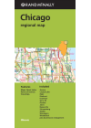
Chicago Regional Rand McNally
Chicago Regional map is for anyone traveling in and around this part of Illinois offering unbeatable…
$15.00
-

Washington DC & Eastern Corridor USA ITMB
This map of Washington DC & Eastern Corridor by ITMB is a double sided map with Washington DC…
$15.00
-

Washington D.C. Borch
This map of Washington D.C. by Borch details Washington Downtown, The Mall, Washington and Region…
$15.00
-
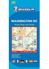
Washington D.C. Michelin 190
This Michelin map of Washington D.C. is accurate and easy to read with its detailed index. It…
$17.00$15.00
-
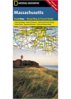
Massachusetts National Geographic
This NGS Massachusetts map's road network is complemented by a user friendly index of counties…
$15.00
-
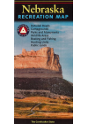
Nebraska Recreation Benchmark
The Nebraska Recreation Map is the ideal planning tool for everything outdoors, from a rugged…
$15.00
-

Las Vegas Michelin Streetwise
Las Vegas, the oasis in the middle of the Nevada desert. Not only can you take part in the betting…
$15.00
-

Pennsylvania Rand McNally
This map of Pennsylvania by Rand McNally shows all Interstate, US, state and county…
$17.00$15.00
-
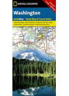
Washington State National Geographic
NGS' Washington map is designed to meet the needs of travelers with detailed and accurate…
$15.00
-
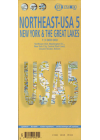
USA Northeast Borch
This Borch map of USA Northeast covers New York & Great Lakes, Greater Boston, Central East…
$16.00
-

Pan-American North ITMB
This ITMB travel atlas of the Pan-American North will help you plan your route, prepare your…
$25.00$16.00
-
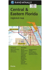
Central & Eastern Florida Rand McNally
This Rand McNally map of Central & Eastern Florida displays road networks in detail…
$19.00$16.00
-
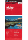
Idaho Rand McNally
This map of Idaho by Rand McNally details Interstate, U.S. state and county highways along with…
$16.00
-

Indiana Rand McNally
This map of Indiana by Rand McNally depicts Interstate, U.S. state and county highways along with…
$16.00
-
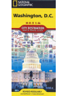
Washington D.C. National Geographic
NGS' map of Washington D. C. is a comprehensive guide to the city, combining an easy-to-read road…
$16.00
-

Montana & Wyoming Rand McNally
This Rand McNally map of Montana & Wyoming depicts all Interstate, U.S. state and county…
$16.00
-

Montana & Wyoming State Rand McNally
This Rand McNally state map of Montana & Wyoming conveys road networks, highways…
$18.00$16.00
-

New York City Pocket Freytag & Berndt
This New York laminated city pocket map by Freytag & Berndt will allow users to navigate this…
$18.00$16.00
-
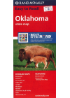
Oklahoma Rand McNally
This Rand McNally map of Oklahoma depicts all Interstate, U.S. state and county highways along with…
$16.00