USA
-
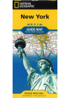
New York State National Geographic
Explore the many diverse recreational activities and attractions in "The Empire State" with National…
$20.00
-
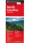
North Carolina Rand McNally
This Rand McNally map of North Carolina displays all Interstate, U.S. state and county highways…
$18.00
-
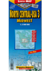
North Central USA Midwest Berndtson & Berndtson
This map of North Central USA Midwest by Berndtson & Berndtson will help users to navigate this…
$15.00$10.00
-
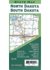
North Dakota South Dakota Gm Johnson
This map of North Dakota & South Dakota by GM Johnson is a double sided map with the 2…$12.00
-
Northeastern USA & Eastern Canada Michelin 583
This Michelin map of Northeastern USA & Eastern Canada has extensive coverage of primary…
$18.00
-
Northern California National Geographic
This map of Northern California by NGS is a handy combination of map and guidebook, loaded with…
$20.00
-
Northern California Rand McNally
This Rand McNally state map of Northern California highlights road networks, highways, county…
$13.00$11.00
-
North Las Vegas & Paradise/Sunrise Manor Rand McNally
This street map of North Las Vegas & Paradise/Sunrise Manor by The Thomas Guide will help…
$12.00$10.00
-
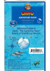
Oahu Hawaii Adventure Guide Franko
This map of Oahu by Franko is a recreational map for scuba divers, snorkelers, kayakers, hikers…
$17.00
-
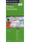
Oahu & Honolulu Rand McNally
This Rand McNally street map of O'ahu & Honolulu depicts road networks in detail along with…
$15.00$13.00
-
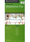
Oklahoma City Rand McNally
This Rand McNally street map of Oklahoma City depicts road networks in detail along with…
$10.00$7.00
-
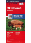
Oklahoma Rand McNally
This Rand McNally map of Oklahoma depicts all Interstate, U.S. state and county highways along with…
$16.00
-
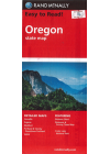
Oregon Rand McNally
This Rand McNally map of Oregon depicts all Interstate, U.S. state and county highways along with…
$16.00
-
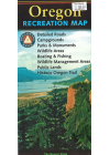
Oregon Recreation Map Benchmark
This Oregon Recreation map by Benchmark Maps is the ideal planning tool for everything…
$23.00
-
Orlando Borch
This map of Orlando by Borch covers Orlando Downtown, Central Florida, Orlando and Region, Walt…
$12.00$9.00
-
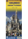
Orlando & Central Florida ITMB
This ITMB map of Orlando & Central Florida is easy-to-use, helping you to plan your trip and to…
$18.00
-
Orlando & Walt Disney World Resort Insight
This Insight Guides map of Orlando & Walt Disney World Resort includes maps of Walt…
$15.00$12.00
-
Pacific Northwest Michelin 171
This Michelin map of the Pacific Northwest focuses on Washington and Oregon while extending over the…
$15.00
-

Pan-American North ITMB
This ITMB travel atlas of the Pan-American North will help you plan your route, prepare your…
$25.00$16.00
-

Pennsylvania Rand McNally
This map of Pennsylvania by Rand McNally shows all Interstate, US, state and county…
$17.00$15.00
-

Philadelphia & Mid-Atlantic States ITMB
This ITMB map of Philadelphia & Mid-Atlantic States of USA is waterproof and…
$13.00
-

Phoenix Borch
This map of Phoenix by Borch covers Downtown Phoenix, Downtown Scottsdale, Arizona, Heritage Square…
$10.00$8.00
-
Phoenix Rand McNally
This Rand McNally street map of Phoenix highlights road networks in detail along with various points…
$10.00$7.00
-
Phoenix & Tucson Rand McNally
This Rand McNally map of Phoenix & Tucson displays road networks in detail along with points of…
$13.00$10.00
-
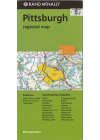
Pittsburgh Regional Rand McNally
This Rand McNally map of Pittsburgh highlights road networks in detail along with various…
$12.00$8.00
-
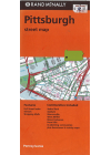
Pittsburgh Street Rand McNally
This map of Pittsburgh by Rand McNally displays all Interstate, U.S. state and county highways along…
$12.00$9.00
-
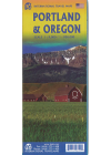
Portland & Oregon ITMB
This map of Portland @ 1:9,000 and the State of Oregon @ 1:900,000. The map of Portland on one…
$20.00
-
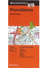
Providence Rand McNally
This Rand McNally map of Providence covers all Interstate, U.S. state and county highways along…
$12.00$9.00
-
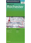
Rochester Rand McNally
This Rand McNally street map of Rochester potrays road networks in detail along with various points…
$9.00$6.00
-
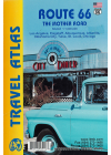
Route 66 ITMB Atlas
This ITMB atlas of Route 66 covers Los Angeles, Flagstaff, Albuquerque, Amarillo, Oklahoma City…
$21.00
-
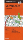
Sacramento Rand McNally
This Rand McNally map of Sacramento depicts all Interstate, U.S. state and county highways along…
$12.00$9.00
-
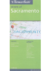
Sacramento streets Rand McNally
This street map of Sacramento by Rand McNally contains extensive details of the city's road network…
$10.00$8.00
-
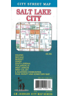
Salt Lake City GM Johnson
This GM Johnson map of Salt Lake City will help users to plan their route with ease. It…
$12.00$8.00
-
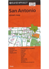
San Antonio Rand McNally
This Rand McNally map of Sacramento depicts all Interstate, U.S. state and county highways along…
$12.00$9.00
-

San Francisco Borch
This easy-to-fold laminated city map of San Francisco features large-scale street plans, including a…
$18.00$15.00
-
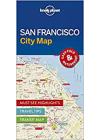
San Francisco Lonely Planet City Map
This city map of San Francisco by Lonely Planet will help users to plan their trip using its travel…
$15.00$10.00
-
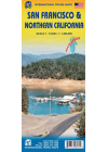
San Francisco & Northern California ITM
San Francisco must be one of the most interesting and livable cities in America; certainly a great…
$17.00
-

San Francisco PopOut
This PopOut map of San Francisco is small in size yet big on detail, being compact and dependable in…
$10.00$8.00
-
 Sale
Sale
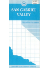
San Gabriel Valley
This map of the San Gabriel Valley by AAA has all streets and is fully indexed The San Gabriel…
$12.00$7.00
-

Seattle Borch
This Borch map of Seattle includes a map of the city center along with a detailed street index to…
$16.00
-
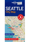
Seattle Lonely Planet City Map
This city map of Seattle by Lonely Planet will help you to plan your trip using its travel tips…
$13.00$11.00
-

Seattle Popout
Seattle, part of the Popout map series, is a pocket-sized, folded, laminated map for those exploring…
$10.00$8.00
-
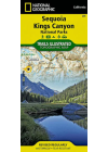
Sequoia Kings Canyon National Geographic Trails Illustrated
This NGS map of Sequoia and Kings Canyon National Parks was created in partnership with local land…
$20.00
-
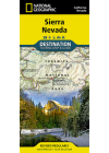
Sierra Nevada National Geographic
NGS' Sierra Nevada map is ideal resource for touring the rugged landscape of this culturally and…
$27.00
-
South Atlantic States USA ITMB
This map of the South Atlantic States USA by ITMB covers Florida's Caribbean coastline as well…
$12.00$10.00
-
South Carolina Rand McNally
This Rand McNally map of South Carolina depicts all Interstate, U.S. state and county highways along…
$18.00
-
South Central USA Hallwag
This Hallwag map of South Central USA covers the Central Plains and the Mississippi…
$24.00$20.00
-
Southeastern USA Michelin 584
This Michelin map of Southeastern USA offers extensive coverage of primary, secondary and scenic…
$18.00
-
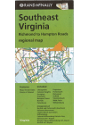
Southeast Virginia Rand McNally
This Rand McNally map of Southeast Virginia highlights road networks in detail along with…
$12.00$9.00
-
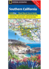
Southern California National Geographic
NGS' Southern California map provides travelers with the perfect combination of detail and…
$25.00
-
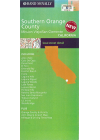
Southern Orange County Rand McNally
This Rand McNally map of Southern Orange County highlights road networks in detail along with…
$9.00$6.00
-
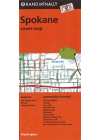
Spokane Rand McNally
This Rand McNally map of Spokane depicts all Interstate, U.S. state and county highways along with…
$12.00$9.00
-

Staten Island Rand McNally
This street map of Staten island by Rand McNally highlights road networks in detail along with…
$9.00$6.00
-
Tennessee National Geographic
This NGS guide map of Tennessee combines a comprehensive road map with an expertly research travel…
$20.00
-
Texas & Oklahoma ITMB
This ITMB map of Texas & Oklahoma includes an urban map of Amarillo, Tulsa and Oklahoma…
$13.00
-
Texas & Oklahoma National Geographic Adventure
This NGS United States Texas and Oklahoma Adventure Map will guide you through the vast state of…
$20.00
-

United States Rand McNally
This Rand McNally interstate map of the United States depicts all Interstate and U.S. highways along…
$20.00
-
USA East Half ITMB
This map of the USA East Half by ITMB has one side covering the Atlantic seaboard from Maine to…
$15.00
-
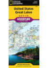
USA Great Lakes National Geographic Adventure
This NGS United States Great Lakes map will guide you to the five Great Lakes of Superior, Michigan…
$25.00
-
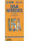
USA Interstate Borch
This map of the USA is a double sided colour road map in scale 1:4,000,000 and distinguishes roads…
$20.00
-
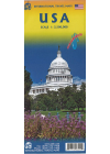
USA Itmb
This road & rail map of USA @ scale 1:3.5m & printed on 2 sides on waterproof paper shows major…
$17.00
-
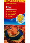
USA Marco Polo
A fold-out overview map is ideal for route planning. Scenic routes and places of interest are…
$20.00
-
USA Michelin 761
Michelin's map of the USA #761 @ 1:3,450,000 has a comprehensive key, complete name…
$25.00
-
USA Northeast Borch
This Borch map of USA Northeast covers New York & Great Lakes, Greater Boston, Central East…
$16.00
-
USA Northern Plains National Geographic Adventure
This NGS United States Northern Plains Adventure Map will guide you though a varied landscape, from…
$30.00
-
USA Northwest Borch
This map of the USA Northwest by Borch distinguishes roads ranging from expressways to secondary…
$22.00
-
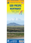
USA Pacific Northwest ITMB
This ITMB map of the USA Pacific Northwest covers the states of Washington, Oregon and Idaho along…
$13.00
-
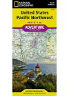
USA Pacific Northwest National Geographic Adventure
This NGS United States Pacific Northwest Adventure Map will guide you through the states of…
$27.00
-
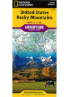
USA Rocky Mountains National Geographic Adventure
This NGS United States Rocky Mountains Adventure Map will guide you through one of the most rugged…
$25.00
-
USA Southeast Borch
This map of USA Southeast by Borch @ 1:3,000,000 covers from the Florida Keys to Springfield…
$22.00
-

USA Southeastern Plains Gulf Coast National Geographic Adventure
This NGS Southeastern Plains and Gulf Coast Adventure Map will guide you through the southern…
$30.00
-
USA Southeast National Geographic Adventure
This NGS United States Southeast Adventure Map will guide you through the diverse landscapes of this…
$30.00
-
USA Southwest Borch
This map of USA Southwest by Borch @ 1:3,000,000 covers from the California coast to the…
$22.00
-
USA Southwest National Geographic Adventure
This NGS United States Southwest Adventure Map will guide you through the states of Arizona and New…
$30.00
-
USA West Canada West Michelin
Michelin's USA West Canada West map with scale 1:2 400 000 (1cm=24km) is a road and tourist map that…
$25.00
-
US Canada Border ITMB
This ITMB map of US Canada Border will help you to plan your trip, to prepare your…
$20.00
-

US/Mexico Border ITMB
This ITMB map of the US/Mexico Border extends well into both the USA and Mexico. For…
$17.00$14.00
-
US Rocky Mountains ITMB
This ITMB map of the US Rocky Mountains covers Montana, Wyoming and Colorado as well as parts of…
$14.00$12.00
-
Utah Recreation Map Benchmark
This Utah Recreation map by Benchmark Maps is the ideal planning tool for everything outdoors…
$18.00
-

Virginia Rand McNally
This Rand McNally map of Virginia shows all Interstate, US, state and county highways. It also…
$18.00
-

Washington D.C. Borch
This map of Washington D.C. by Borch details Washington Downtown, The Mall, Washington and Region…
$15.00
-

Washington DC & Eastern Corridor USA ITMB
This map of Washington DC & Eastern Corridor by ITMB is a double sided map with Washington DC…
$15.00
-
Washington D.C. Michelin 190
This Michelin map of Washington D.C. is accurate and easy to read with its detailed index. It…
$17.00$15.00
-
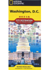
Washington D.C. National Geographic
NGS' map of Washington D. C. is a comprehensive guide to the city, combining an easy-to-read road…
$16.00
-

Washington DC Popout
Washington, part of the Popout map series, is a pocket-sized, folded, laminated map for those…
$10.00$8.00
-
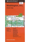
Washington D.C. Rand McNally
This Rand McNally map of Washington D.C. highlights all Interstate, U.S. state and county highways…
$10.00
-
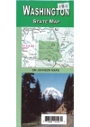
Washington State GM Johnson
This map of Washington by GM Johnson will help you to travel independently in this state. It…
$8.00
-
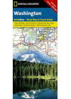
Washington State National Geographic
NGS' Washington map is designed to meet the needs of travelers with detailed and accurate…
$15.00
-
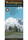
Washington State Recreation Map Benchmark
This Washington Recreation map by Benchmark Maps is the optimal planning tool for everything…
$20.00
-
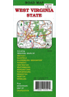
West Virginia GM Johnson
This map of of West Virginia by GM Johnson will allow users to navigate this state with ease using…
$8.00
-
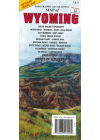
Wyoming Recreation GTR
This recreation map of Wyoming by GTR highlights topography in detail. In addition, points of…
$15.00$12.00
-
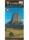
Wyoming Recreation Map Benchmark
This Wyoming Recreation map by Benchmark Maps will help you to plan for everything outdoors, from…
$17.00
-
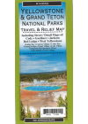
Yellowstone & Grand Teton National Parks GM Johnson
This map of Yellowstone & Grand Teton National Parks by GM Johnson is a double sided map with…
$12.00
-
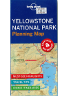
Yellowstone National Park Lonely Planet Planning Map
This planning map of Yellowstone National Park by Lonely Planet will allow users to plan…
$13.00$11.00
-
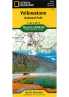
Yellowstone National Park National Geographic Trails Illustrated
This NGS Trails Illustrated map of Yellowstone National Park is expertly researched and created in…
$30.00
-
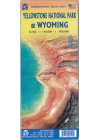
Yellowstone National Park & Wyoming ITMB
The map of Yellowstone @ 1:160,000 & Wyoming @ 1:900,000 by ITMB has a detrailed travel map on…
$20.00
-
Yosemite National Park National Geographic Trails Illustrated
The NGS Yosemite National Park Trails Illustrated map is loaded with helpful information on camping…
$27.00